catalin scrie:
De ceva timp mi-am format o idee despre care as vrea sa aflu si parerea voastra:
Cu cat toamna sunt mai putine invazii de aer rece, cu atat iarna incepe mai puternic in decembrie.
De exemplu anul acesta am avut doar un scurt val de frig pe 30, 31 octombrie cand temperaturile minime au fost negative.
Apoi toata luna noiembrie nu am mai avut minime sub 0°C, iar incepand din 8 decembrie stie toata lumea ce a urmat.
De aici poate ca vine si vorba ca daca ninge timpuriu pe parcursul toamnei, iarna va intarzia sa vina.
Ma gandesc ca intre aceste fenomene exista urmatoarea legatura:
- cu cat mai mult intarzie invazia aerului polar asupra noastra cu atat se acumuleaza mai mult aer rece in nord.
Acum exista si posibilitatea ca aerul rece acumulat in nord sa nu mai vina niciodata asupra noastra si sa ajunga prin alte regiuni ale emisferei nordice si astfel sa apara iernile blande de la noi, dar asta e alta discutie.
Catalin,m-ai provocat!
E tocmai teoria pe care o voi sustine si argumenta, sper in primavara aici, amplu.
Dar sa fim logici, accept cu drag critici.
Nu pretind ca voi putea cuprinde acum totul aici.
Dar,
avand in vedere extensia scazuta a gheturilor la pol la sfarsitul verii, avand in vedere amplasarea centrului gheturilor, a curentilor-jet in astfel de situatie, nu puteam primi aer polar.
Apoi, la venirea iernii acel deficit de 700 000 km patrati (gheata lipsa fata de anul precedent) oceanul a inghetat rapid.Am date, acum doar expun, nu argumentez.
Sigur, era apa dulce de suprafata, erau aisberguri in oarecare proportie...(apa era rece totusi) dar era LICHIDA in mare parte.
A inghetat rapid, dar asta a presupus un schimb intens de caldura ocean-atmosfera,
atmosfera ramanand totusi mai calda decat daca acea suprafata ar fi fost inghetata deja la venirea iernii.
Deci, un plus de energie.
Oceanul a inghetat rapid pana a ajuns pe zile la fel ca in urma cu un an,
insa asta...statistic, km patrati...ei bine erau acei km patrati acoperiti, insa gheata era SUBTIRE, fapt ce a permis inca o mai mare pierdere de energie din partea oceanului fata de anul precedent la aceeasi data.
Deci, un mare interval de timp a fost la pol MAI CALD fata de anul trecut.
Adu-ti aminte cum a fost toamna si prima parte a iernii anul trecut.
Bun.
Pe masura ce gheturile s-au consolidat, formand BANCHIZA, aceasta banchiza a luat nastere aproape brusc, pe masura ce radiatia oceanului a fost mult diminuata.
Atmosfera s-a racit BRUSC, in urma cu nu foarte mult timp...
Sa argumentez si de ce: Daca facem un grafic al energiei cedate de ocean la pol, obtinem o parabola.
Banchiza fiind relativ uniforma, formandu-se BRUSC, energia cedata de ocean a scazut BRUSC si pe suprafata mare a fost "taiat generatorul de caldura", atmosfera racindu-se BRUSC si pe suprafata mare.
In urma formarii banchizei, peste 1milion de metri cubi de apa sarata PE SECUNDA s-au scufundat in adancul oceanului.
Automat din nordul Atlanticului a fost absorbita ACEEASI cantitate de apa...CALDA.
Vezi cat de avansat este ACUM Atlanticul LIBER DE GHEATA!
Automat, acest ocean liber de gheata cedeaza multa energie.
Si umezeala.Aici, sunt sanse sa persiste un camp de presiune scazuta, ceea ce duce automat la un anticiclon in partea continentala prin Rusia.
Scenariu valabil pana acum.
Dincolo de ce se va intampla pana in primavara, concluzia CERTA e ca in urma unui minim de vara al gheturilor curentul Golfului SE INTENSIFICA !!
Asta e concluzia mea.
Pot argumenta cu postari ample date certe si harti.
Si o voi face la primavara, pentru a avea TOT scenariul din aceasta iarna.
Sigur, nu toate iernile seamana, accept critici, sunt utile, dar va rog sa nu uitati esentialul.
Ierni grele pe continent sau nu ramane subiect deschis.
INTENSIFICAREA CURENTULUI GOLFULUI e "calul de bataie" al teoriei.
Ceea ce inseamna paradoxal, gheturi tot mai scazute vara, o incalzire in mare parte din an a Polului, dar, mare atentie, O RACIRE A OCEANULUI !!!
Plus...urmeaza soarele sa scada...apoi o mini ice-age...(2030-2035) ca maxim...
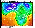
Iata gheturile polare ACUM
A se observa Atlanticul liber de gheata pana unde ajunge.

North Pole Environmental Observatory
Recent findings demonstrate the sensitivity of Arctic Ocean circulation to background, deep-ocean mixing. Results with a large-scale coupled ice-ocean model [Zhang and Steele, 2007] suggest the appropriate model background mixing for the Arctic Ocean is an order of magnitude lower than for ice-free oceans. Background mixing in the deep ocean is related to internal wave energy, which in ice-covered seas has been observed to be lower than in ice-free oceans, and to change with time and bathymetric conditions [Levine et al., 1985 and 1987; Halle and Pinkel, 2003; Pinkel, 2005]. Present thinking is that internal wave energies and background mixing are reduced in ice-covered seas by, among other things, dissipation of internal wave energy in the surface boundary layer immediately below the ice. Consequently, if the ice cover is reduced due to global warming, we may see a climate feedback that has not been considered before. If the ice cover is reduced, we may see increased internal wave energy, mixing, and heat flux in the deep ocean because less internal wave energy would be lost in the under-ice boundary layer. This would tend to result in increased heat flux to the ice, a positive climate feedback that would melt more ice. The effect could arguably be greatest near the continental slopes and submarine ridges, which are the likely areas of greatest internal wave increase and the paths of warm Atlantic water through the Arctic Basin.
The sensitivity ocean circulation and energy balance to background mixing and the criticality of ocean heat and freshwater fluxes, suggest that as the Arctic Ocean changes, we should be tracking background mixing the way we track temperature and salinity. Direct measurements of mixing are difficult, but decades of research show that deep background mixing is a consequence of dissipation of internal wave energy. The exact nature of this relationship is an ongoing question, but it makes it possible to infer mixing from relatively simple observations of internal wave energy [e.g., Gregg, 1989; D'Asaro and Morison, 1992; Kunze et al., 2006]. In our new NSF-OPP project, Sensitivity of Arctic Ocean Change to Background Mixing (ARC- 0909408), we will be gathering together and analyzing existing Arctic Ocean data for internal waves and mixing using new methods, which in many cases have not been applied to the Arctic environment. As part of our renewed North Pole Environmental Observatory Grant (ARC-0856330) we are now dropping eXpendable Current Profilers (XCP) as a standard part of our NPEO airborne hydrographic surveys. The velocity shear measured by these probes, along with the CTD data, gives us a simple estimate of background internal wave energy from which background mixing can be inferred. We are collaborating with Ilker Fer of the University of Bergen in deploying and analyzing both his and our NPEO XCPs. We analyze the XCP data under our "Mixing" grant, and with other data, we will use them to track changes in internal wave energy and related mixing. We will also be performing a simple studies of the energetics of internal waves that combine existing ideas about the forcing of internal waves with new ice model results [Heil and Hibler, 2002; Hibler et al., 2006].
Iar aici puteti vedea clar cum amplitudinea maxim-minim al extensiei gheturilor a crescut cu aproape 25 % fata de anii de inceput ai perioadei analizate.
Deci, an-de-an, mai multa sare se scufunda, la refacerea banchizei, absorbind mereu mai multa apa calda din Atlantic.
http://arctic.atmos.uiuc.edu/cryosphere/arctic.sea.ice.interactive.html